Local Maps & Directions
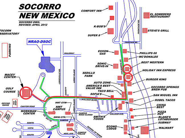
Directions from Best Western/Holiday Inn Express to Macey Center at New Mexico Tech and the NRAO Pete V. Domenici Science Operations Center
- Turn left on to California Road as you exit the hotel parking lot.
- Turn right on to Bullock Road.
- After the second Stop sign on Bullock, the campus of New Mexico Tech is on your left.
- Continue straight. After another block, the road curves to the left. You will see a sign on your right saying "National Radio Astronomy Observatory".
- Turn right into the parking lot – it will be the first possible turn during the curve, on your right – and park anywhere. This lot serves the Macey Center and the NRAO. Macey Center is to the south; NRAO is to the north.
Click the map to view in full detail.
Local Area Maps & Information
Map from Macey Center to IRIS/PASSCAL
New Mexico Tech campus map: http://www.nmt.edu/campus-maps
Socorro City Street map: http://www.socorro-nm.com/images/SocorroStreets.pdf
Socorro Chamber page: http://www.socorro-nm.com/default.htm


Connect with NRAO